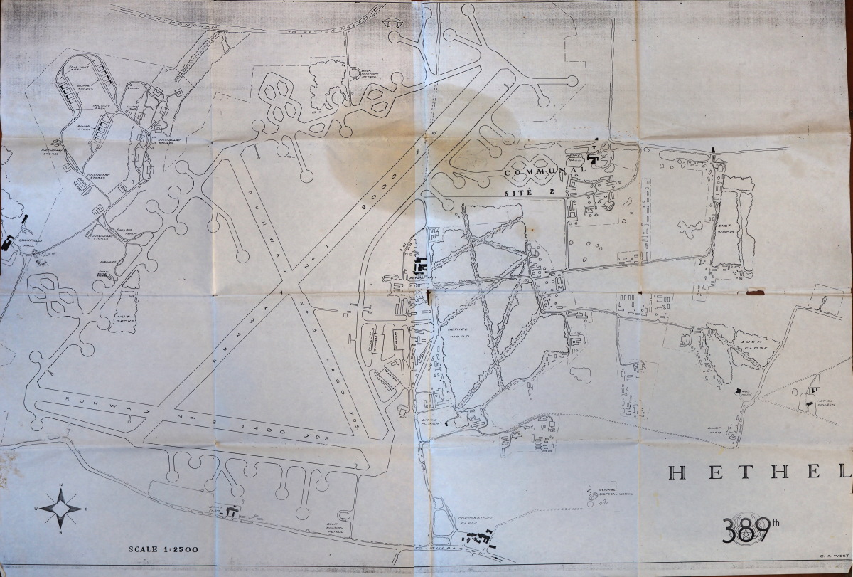
The bomb storage area is shown on the map top-left (North West). Base administration, crew areas, engineering, accommodation, entertainment and medical facilities were all on the map’s right-hand side (East).
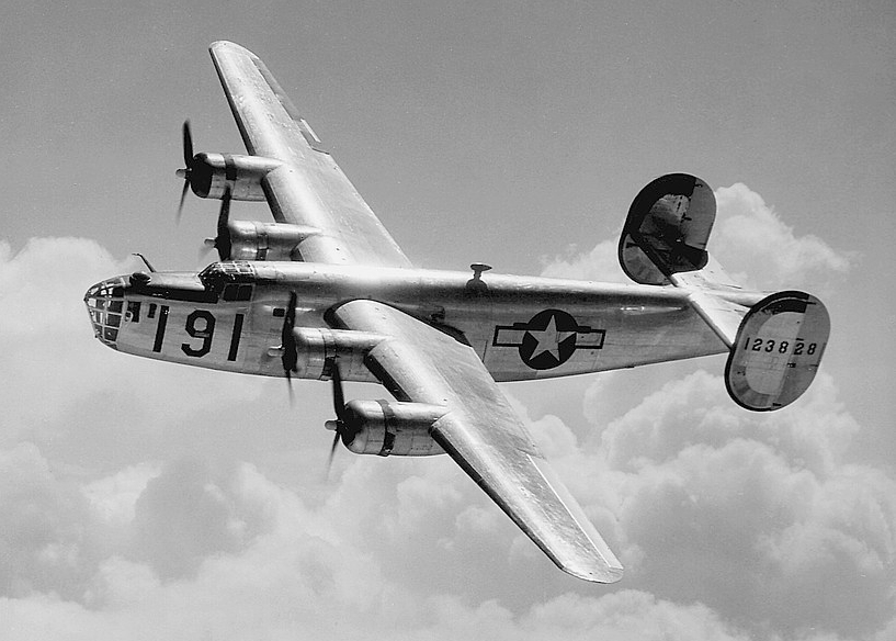
Hethel Airfield was a major base for the US Army Air Force during the Second World War. Although located just outside the boundary of Wreningham, its proximity was always of significance. The main occupant was the 389th Bombardment Group flying B-24 “Liberator” bombers. Arriving in 1943, they departed for home in the the second half of 1944.
The United States Army Air Force was renamed the United States Air Force in 1947.
The above map shows the main (2,000 yard) runway – diagonally NE /SW.
The Americans had also taken over one of the two tracks of the Wymondham-Forncett railway line. Part of this track was sometimes occupied by an ammunition train located in a cutting just to the North West of Hapton.
American hospitality during WW2
The B-24 Liberators would have been a common sight over Wreningham.
The Americans mostly flew daylight sorties so were exceptionally vulnerable. From the 307 missions flown out of Hethel 116 aircraft were lost in action.
Multi-engine propeller driven aircraft make a very distinctive sound – and these heavily laden bombers would have been at their noisiest during take-off. Whenever the wind was coming from the west, south-west, south or south-east, the aircraft would have been taking off in our direction; no-one in the village would have been in any doubt about a mission getting underway.
Between September 1945 and late 1946, Mustang fighter aircraft replaced the earlier bombers – firstly with RAF squadrons and finally by Mustang squadrons operated by Polish crews.
The above photograph (courtesy of Historic England) is a 1944 airborne reconnaissance image of this area taken by the US Army Air Force. For your orientation, North East in this photograph is “up”. The airfield is prominent in the bottom left whilst much of Wreningham can be found from the central to lower-middle edge of the photograph.
Click on the image area to bring up a zoom control – you can also drag the magnified image around the frame. Click on the double-headed arrow in the image’s top right-hand corner and the image will fill your screen!
Without its many modern buildings, Wreningham appears surprisingly “empty” – whilst the curving and long-gone railway line (bottom right) is very prominent.
The website for many more United States WW2 aerial reconnaissance images in the UK (including the above) can be found here.
Post WW2 – at “The Camp” – the old Hethel Airfield
In 1954, there was an investigation to determine if the main runway could be extended by another 600-700 yards. That would have resulted in Hethel’s runway becoming about the same length as the secondary/standby runway at Gatwick! Fortunately for us, the investigation determined there were too many issues hindering the runway extension plan – although the direct proximity of Wreningham wasn’t one of them!