The parish of Wreningham comprises about 1,500 acres of land. Unsurprisingly, the majority is farmland; and much of the story of our village has been built around agriculture.
The ownership and tenancies of the land and their successes (or sometimes failures) in producing crops and raising animals over hundreds of years is probably key to understanding the dynamics of the entire village community. What the farmers achieved ultimately put money in people’s pockets, kept the shops and traders busy and helped to keep large numbers of people fed and clothed.
Traditionally, all farmer’s fields have names. These are usually passed down through the generations. Names and can commonly relate to a specific detail about the location or even an ancient event.
Cartographers, who have tidier minds(!) normally identify field by numbering them, instead. Whilst the Ordnance Survey map will print the numbers or their map, the farmer will often overwrite these with their own more familiar lexicon.
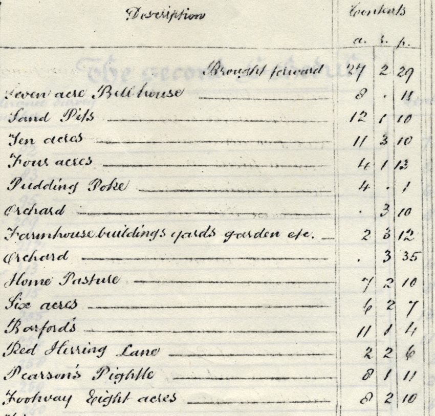
Tithe maps have their own numbering system – together with their tables listing ownership and tenancies. Details date from the first half of the 1800s; the records are a good place to see the complexity and the extent of the village land ownership and occupancy. Labourers, merchants, blacksmiths, wheelwrights, herdsmen, millers and many others will have been intimately involved with the successful utilisation of the land. The changing generations of farmers will have provided useful levels of business to solicitors and auctioneers too.